Strong winds are expected to move through the area on Saturday, causing the Essex Region Conservation Authority (ERCA) to issue a Shoreline Conditions Statement for the Lake St. Clair and Lake Erie shorelines, including Pelee Island.
Wind speeds are expected to increase Saturday evening to over 30 kilometres per hour, coming from the east-north-east. By mid-afternoon Sunday, January 31, winds could reach sustained speeds of up to 45km/hr with gusts around 50km/hr.
By Monday, February 1, winds are expected to remain between 35-45km/hr out of the northeast, potentially subsiding by the evening hours and shifting out of the north.
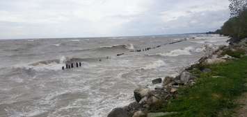
The ERCA said in a statement Saturday that the current water levels and coming winds are not enough to prompt a Flood Watch. They added, however, that there is still an elevated risk of flooding and erosion along certain shorelines.
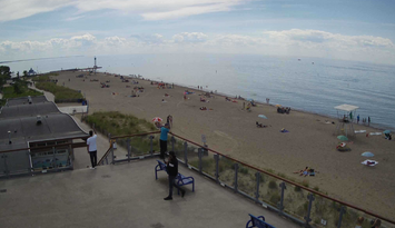
Areas of particular concern include the Lake Erie shoreline between Wheatley Harbour and Point Pelee National Park and the Lake St. Clair shoreline from Belle River to the City of Windsor.
Ice coverage remains low across both lakes, and ERCA warned that newly formed ice will be too weak to withstand the potential wave activity. This could cause ice to break and be swept ashore. Additionally, due to colder temperatures, any wave splashing could freeze on land very easily, causing slippery conditions.
For these reasons, ERCA is encouraging people to stay safe and to take extra caution to avoid areas where flooding is occurring as well as rivers, streams, and shoreline areas. Children, pets, and livestock should be kept away from flowing or standing water as well as the effected shoreline areas.
The Shoreline Conditions Statement will remain in effect until Monday, February 1 at 5:00 p.m.