The Essex Region Conservation Authority has issued a flood warning for Leamington, Lakeshore, and Pelee Island as strong winds cause flooding.
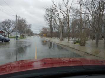
In Leamington, water is over the road on Point Pelee Drive (County Road 33) with the most affected area being between Sturgeon Creek and Mersea Road 12.
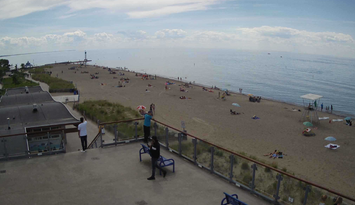
The low lying beach communities of Ruscom River east to Lighthouse Cove in Lakeshore are experiencing significant splashing and spray due to strong winds and elevated lake levels.
Conservation officials have reported significant flooding in the Lighthouse Cove community, with water around many homes and on several roadways. The main roads affected are Tisdelle, Melody and Island Cresent. Flooding is expected to continue overnight and everyone is asked to avoid these areas if possible.
"West winds have caused water levels to rise in eastern Lake St. Clair which has caused water to rise in the canals within the community. Water from the canals has spilled out onto the land," the Lower Thames Valley Conservation Authority said in a news release. "Along the shoreline, waves and wave spray have caused flooding in the rear yards of properties which has run to the front of the properties and is crossing over some roads."
On Pelee Island, the west shoreline is experiencing accelerated erosion along West Shore Road and McCormick Road. The Township of Pelee has closed West Shore Road just south of the Ferry Ramp to East-West Road as well as McCormick Road south of the waste transfer station.Forecasts indicate strong winds out of the west blowing over Lake St. Clair and Lake Erie are expected to last until Tuesday morning.