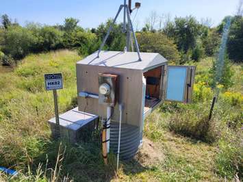
The Saugeen Valley Conservation Authority (SVCA) has launched a new way to view real-time local water data.
The data that is collected by the SVCA's hydrometric monitoring network can now be viewed with hourly data online through the Collaborative Water Data Viewer.
Data on local rain and snowfall has been getting updated on a biannual basis since 2023 by the SVCA. Now data can be monitored much more quickly with this new technology.
There is also information now available on historical and new data concerning water level, streamflow, air temperature, water temperature and soil moisture.
Data from 180 stations across numerous conservation authorities is available, with historic information dating back as far as 1914.
You can view the newly available Collaborative Water Data Viewer here: https://www.saugeenconservation.ca/en/water-management-and-protection/water-and-climate-data.aspx