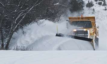
The evening commute across midwestern Ontario Wednesday is sure to be a messy one as a major winter storm is expected to dump as much as 30 centimetres of snow.
The low pressure system from Texas, packing heavy snow, ice pellets, and freezing rain, will arrive in the region late in the afternoon with the heaviest snowfall expected in the evening.
Environment Canada has Huron County, Perth County, and Bruce County under a snowfall warning. Grey County and north Wellington County have a winter storm warning in effect.
According to the snowfall warning, 15 to 25 centimetres could fall by Thursday morning with peak snowfall rates of 2 to 4 centimetres per hour. The snow will become mixed with ice pellets and possibly freezing rain Thursday morning before it gradually tapers off.
Areas under the winter storm warning can expect peak snowfall rates possibly exceeding 5 centimetres per hour with total snowfall amounts of 20 to 30 centimetres, the national weather agency stated.
The rapidly accumulating snow will make travel difficult
"Certainly the drive home Wednesday evening is going to be impacted with that snow beginning by mid-afternoon and then thickening up as we get into that evening rush hour," said Environment Canada Warning Preparedness Meteorologist Geoff Coulson. "[There] may be even some impacts on Thursday morning as well, even though the worst of the snow will be departing the area, we could still be dealing with again the aftermath of that snow and ice pellet for the drive in on Thursday morning."
Area residents are being told to consider postponing non-essential travel until conditions improve.
While the winter storm will move out Thursday morning, there will only be a short reprieve from the wintry conditions as another system is making its way to the area. Coulson said it will arrive Saturday morning and stick around into the early hours of Sunday.
"It's a little too early to tell how much snow could fall with this system," Coulson noted.
~With files from Stephanie Chaves.