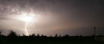
People in many parts of southwestern Ontario are being told to brace for some stormy weather into the evening Wednesday.
Environment Canada has issued a severe thunderstorm watch for London-Middlesex, Elgin County, Oxford County, Windsor-Essex, Chatham-Kent, and Sarnia-Lambton.
At around 5 p.m., Wednesday, watches were upgraded to warnings for areas in Sarnia, Chatham, Petrolia, Forest, Parkhill, Rodney and Strathroy. All areas were downgraded back to a watch just after 6 p.m.
"Thunderstorms have developed over Michigan and are tracking towards the area. After this line of thunderstorms, another line of thunderstorms may track over the area late [Wednesday] evening or overnight," the national weather agency said.
These thunderstorms could produce damaging winds with gusts up to 100 km/h and hail the size of ping-pong balls. This has the potential to cause damage to buildings, vehicles, and trees.
Severe thunderstorms that passed through southwestern Ontario on Tuesday spawned a weak tornado in London. A preliminary investigation by Western University’s Northern Tornadoes Project confirmed the twister as an EF0 with winds speeds up to 115 km/h.
The storms come as the region deals with sweltering conditions that prompted Environment Canada to issue a heat warning for the next couple of days.
Cooler, less humid air, which will reduce the risk of volatile weather conditions, is expected to move in late Friday or Saturday.