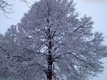
Last week it was extremely cold, this week a wintry mix is in store.
Environment Canada says there's the risk of freezing drizzle overnight, and periods of freezing rain, rain or snow Tuesday, Wednesday, Thursday, and into Friday.
The weather agency issued a special weather statement for Sarnia-Lambton Monday, advising of the potential for several hours of freezing rain overnight Tuesday into Wednesday morning.
The thaw following the deep freeze continued Monday with the temperature climbing to nearly 10 C, 50 F, by early afternoon.
The mercury at Chris Hadfield Airport hit 9 C, 48 F, at mid-afternoon Sunday.
The mild temperatures and rain prompted an area conservation authority to issue a flood water safety message Monday.
The Ausable Bayfield Conservation Authority said a moderate rise in streamflow was occurring, and there was slight potential for ice jams.
The authority said major flooding was not expected but residents around the watershed were being reminded to stay away from creeks, rivers and other watercourses.
The warm-up will be fairly brief with a high near -2 C, 28 F, Tuesday, and unseasonably cold daytime temperatures around -7 C, 19 F, Friday into Saturday.