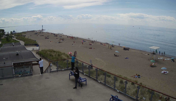
A record high temperature in Sarnia was unofficially reached for a second straight day Friday as the week-long heatwave continued.
The mercury hit 35 C (95 F) at 4pm at Sarnia's Chris Hadfield Airport, with the standing record for the date being 32.9 C set in 1988.
Thursday, Sarnia's high of 34.3 C (93 F) smashed the previous record for August 11 of 31.9 C, also set in 1988.
Environment Canada Meteorologist Geoff Coulson says a slow-moving cold front approaching from the northwest will move into the region Friday night and gradually bring relief from the heat and humidity by Sunday.
He says there is the chance of thunderstorms, possibly heavy, as the front moves through.
"We are going to be seeing more in the way of scattered shower and thunderstorm activity both Friday afternoon and evening, during the overnight hours as well, and off and on during the day on Saturday as this front moves slowly through," says Coulson. "The forecast high on Saturday is 27 C which is somewhat below the values we've see the last few days but it's still going to be very humid and that humidity is still going to make it feel like 37 C."
Sunday will see a return to more seasonable, less humid conditions, with a forecast high of 26 C (79 F).