For the fourth month in a row, the Lower Thames Valley Conservation Authority (LTVCA) has issued a standing flood watch for the Lake Erie and Lake St. Clair shorelines.
Standing messages were also issued in May, June, and July.
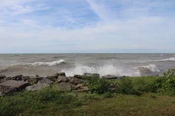
Conservation officials said the current water levels in both Lake Erie and Lake St. Clair are near the record high, which was set in 2019. Thunderstorms or heavy rainfall and moderate wind gusts could cause flooding and shoreline damage.
Water levels in Lake Erie are predicted to drop by 10 centimetres throughout the month, according to the LTVCA. Meanwhile, levels for Lake St. Clair are predicted to drop seven to eight cm.
The risk of flooding and shoreline damage is "essentially the same as they were last year" during peak water levels in the summer but the extent of flooding this year will depend on wind speeds, direction, and the waves.
"Current water levels on the lakes are equal to, or are exceeding, the all-time record monthly averages for August set last year," read a release from the LTVCA. "Compared to last year, or even compared to earlier this year, the very small differences in water levels we currently have and expect by the end of the month, are not significant in terms of the flood risk they present."
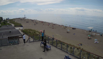
Depending on wind direction, some areas are at a higher risk of flooding or erosion include Erie Shore Drive, Lighthouse Cove, the bay side of Erieau, Shrewsbury, and Rose Beach Line.
Residents who live along the shorelines are asked to monitor conditions and prepare accordingly.
"During the summer, forecasting shoreline flooding becomes even more challenging. Conditions over the lakes can change quickly and with little warning," read the media release.
Although the flood watch is a standing message for the month of August, it may be upgraded depending on future conditions.